Categories
Blog

3D LASER SCANNING IN INDUSTRIAL FACILITIES

Industrial facilities stand as testaments to human ingenuity and progress. However, with their vast size, intricate machinery, and constant activity, they present unique challenges for construction and renovation projects. Their sheer size, complex equipment layout, and continuous occupancy demand advanced surveying techniques for accurate data capture without disrupting operations.

Traditional surveying methods struggle to keep pace with the needs of these environments, often resulting in inefficiencies and inaccuracies. This is where 3D laser scanning shines!

In this article, we’ll explore the importance of laser scanning for construction, renovations, and facility management in industrial settings, and address the specific challenges associated with scanning industrial buildings. Let’s dive in!

When To Use 3D Laser Scanning in Industrial Facilities?

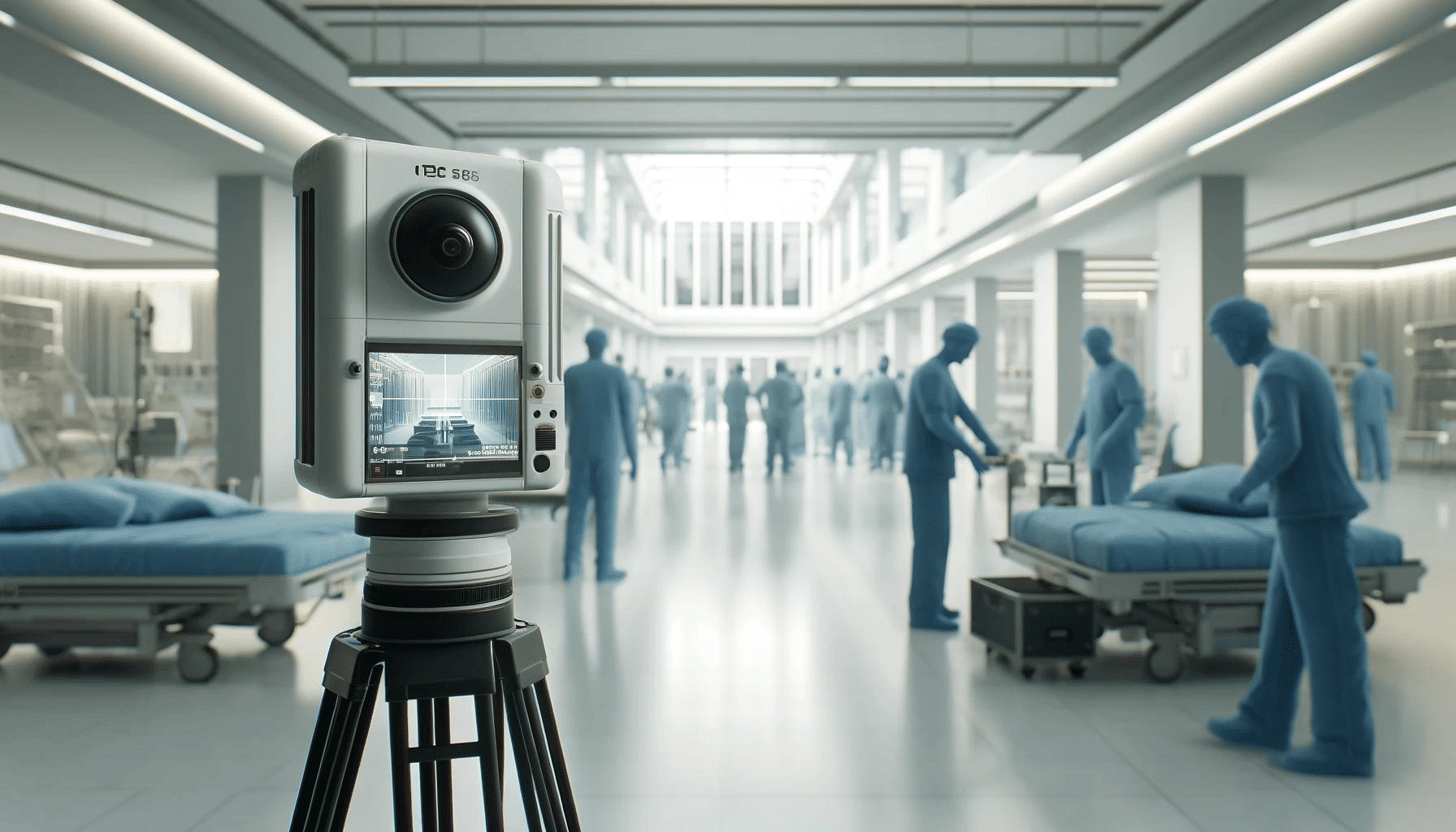
Industrial plants are labyrinthine structures with hard-to-reach spaces, which make them nearly impossible to measure without accounting for potential risks and hazards. Moreover, many facilities run around the clock, so shutting down plants for measuring purposes can pose a major hurdle. But, with 3D laser scanning, owners can leverage the power of reality capture to overcome these challenges!

In addition, owners often want to build or redesign new facilities. However, in many instances, the current installation buildings lack plant layouts or past records.

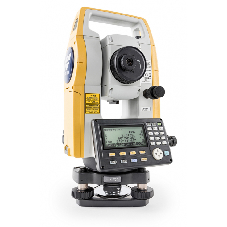
The traditional method of documenting existing layouts usually involves tape measuring, which is prone to measurement mistakes like human error and changes that are not updated regularly. In these cases, a laser scanner can accurately supply the required data on current layouts for planning purposes. By documenting existing conditions, scanning serves as a verification tool, offering valuable insights for designers and engineers.

Advantages of 3D Laser Scanning

●      Rapid Data Capture with High Accuracy and Detail

One of the most significant advantages of 3D laser scanning is its unparalleled accuracy and detail. 3D laser scanners can capture vast amounts of data in a fraction of the time compared to traditional methods.

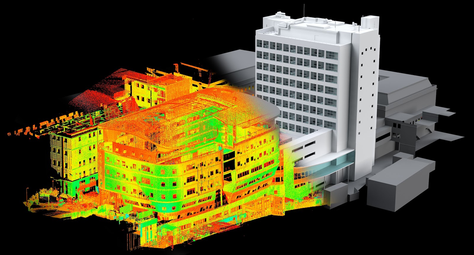
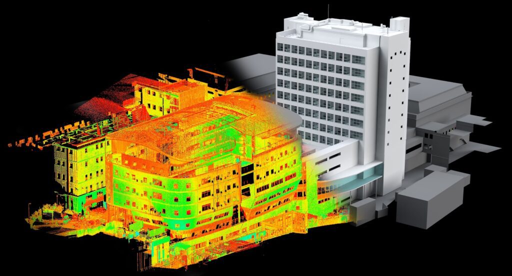
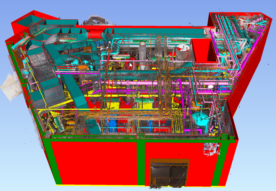
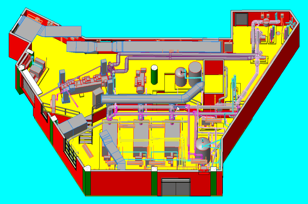
Advanced scanning devices emit thousands of laser pulses per second, generating highly detailed point clouds with sub-millimeter accuracy. These scanners can capture intricate features and nuances that may go unnoticed by traditional methods. This accuracy is invaluable in engineering and design processes, allowing AEC professionals to work with real-world data rather than relying solely on blueprints or outdated measurements.

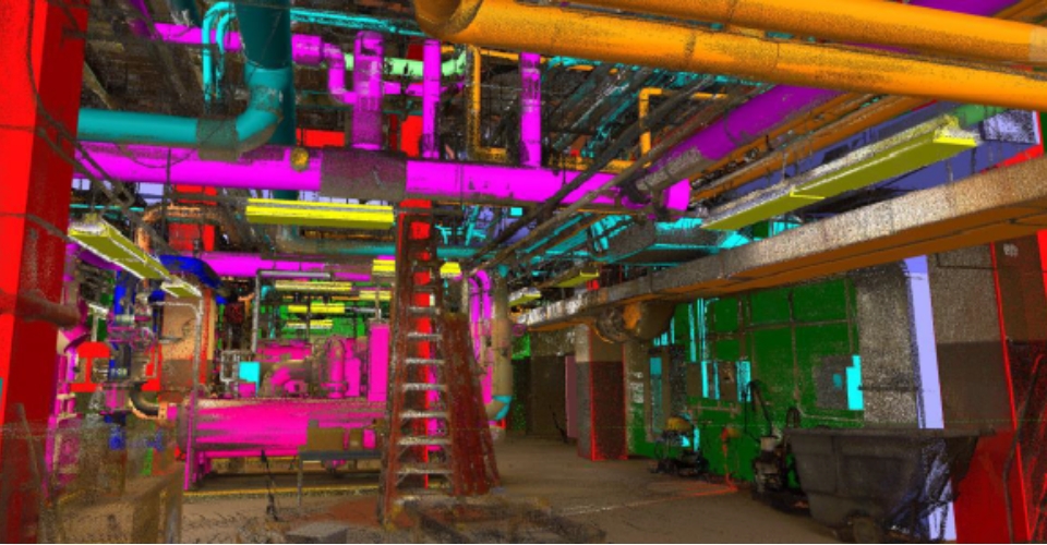
By capturing comprehensive data of machinery, equipment, pipelines, and infrastructure, scanning offers more accurate planning, retrofitting, and maintenance activities, while minimizing errors and optimizing resource utilization.

●      Non-contact Precision for Comprehensive Coverage

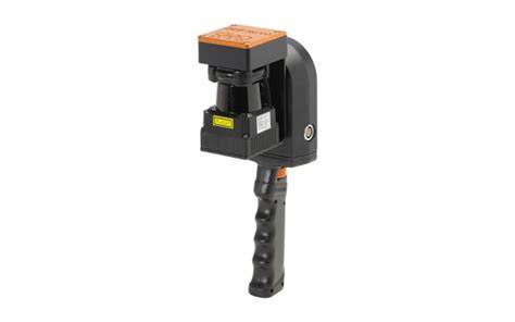
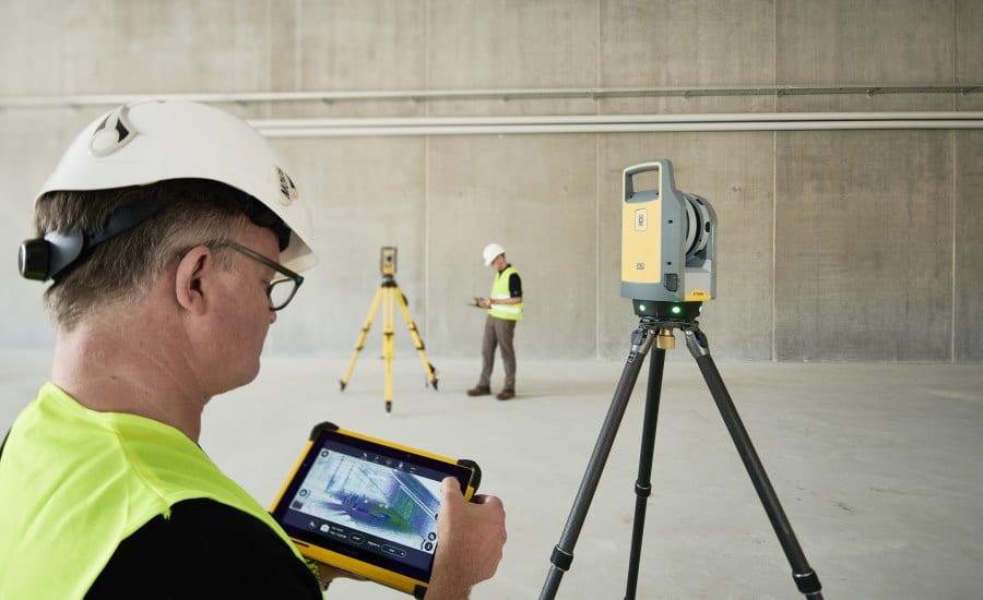
Unlike traditional methods, 3D laser scanning is entirely non-contact, eliminating the need for physical interaction with the surveyed objects. This not only ensures operator safety but also minimizes the risk of damage to delicate equipment or structures. With exceptional range and versatility, 3D scanning enables detailed coverage of industrial facilities, including hard-to-reach areas and complex geometries.

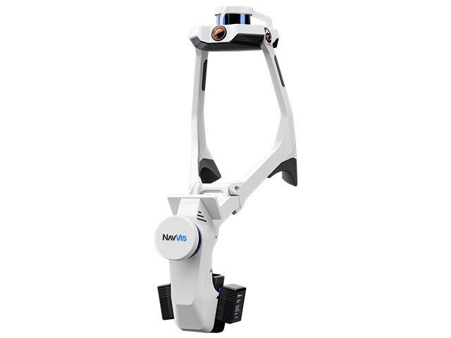
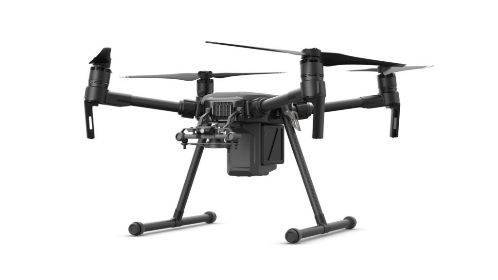
Laser scanners have the ability to capture 360-degree data from multiple vantage points, making sure no detail in sight is overlooked for facilitating thorough analysis and decision-making. Further, special tripods and accessories provide access to challenging areas above equipment or within interstitial spaces, ensuring comprehensive data collection without disrupting ongoing operations.

●      Navigating the Complexity of Industrial Facilities

Industrial buildings are not just large but have complex configurations coupled with structural elements and machinery. Traditional surveying methods struggle to capture the intricacies of these environments, often leading to incomplete or inaccurate data. With its ability to swiftly and accurately capture these complexities, laser scanning emerges as the preferred choice for industrial renovations.

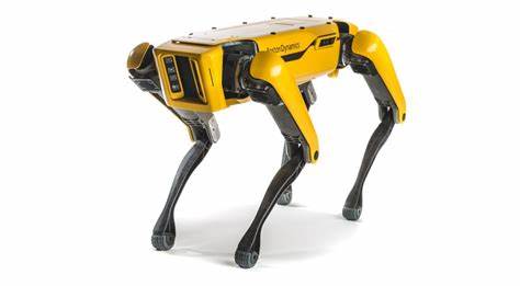
Additionally, mobile scanning devices are versatile tools that complement scanning efforts, by providing access to areas that are hard to reach. However, it’s crucial to strike a balance between accessibility and accuracy when choosing the right equipment for the task at hand.

●      Time and Cost Savings

Traditional methods of surveying and documentation are labor-intensive and time-consuming. By reducing the need for manual measurement and surveying services, scanning lowers labor costs and accelerates project timelines. Moreover, the ability to detect design flaws and construction issues early in the project lifecycle minimizes costly rework and material wastage.

Additionally, achieving ongoing operations with minimal disruptions is considered one of the most significant challenges in industrial renovations. Through laser scanning and non-intrusive technologies, data is captured with minimal to no disruption to the normal pace of the facility. By avoiding downtime and interruptions, construction projects can proceed smoothly, ensuring timely completion and minimal impact on productivity.

Practical Applications of 3D Laser Scanning in Industrial Facilities

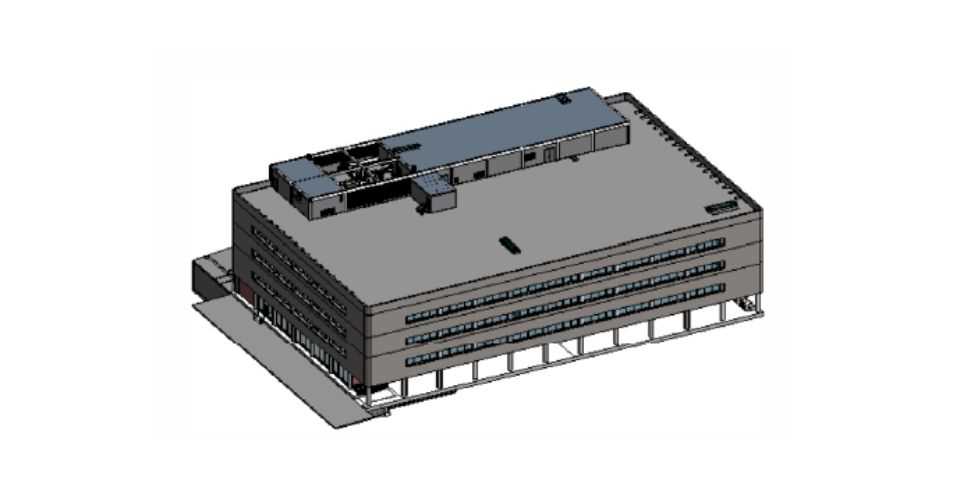
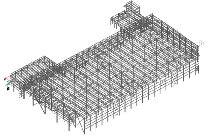
Design and Construction

Effective collaboration is the cornerstone of successful industrial projects. 3D laser scanning streamlines the design and construction phases by enabling precise as-built documentation of existing structures and offering a source of truth for data sharing and visualization. Engineers, architects, and contractors can overlay new designs onto scanned models, ensuring compatibility and minimizing errors.

Additionally, the technology aids in identifying potential clashes and discrepancies early in the process, saving time and resources. Whether it’s conveying design concepts to clients or coordinating tasks among project teams, the ability to present detailed 3D models fosters clearer understanding and alignment.

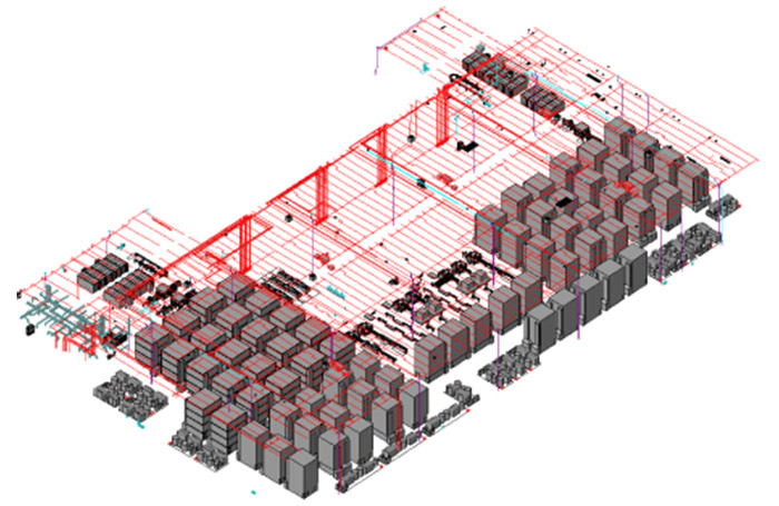
Facility management, Maintenance and Asset Management

Industrial facilities typically have a wide array of complex assets that require meticulous management to ensure operational efficiency and regulatory compliance. Equipment downtime of any kind can translate into significant financial losses. 3D laser scanning simplifies asset management and proactive maintenance by providing accurate data that enables the creation of digital twins of equipment and infrastructure. These digital replicas provide a comprehensive visual representation of assets, complete with detailed information about machinery, such as specifications, installation dates, and maintenance records.

By centralizing asset information in a digital format, facilities can streamline maintenance schedules, identify potential issues, minimize shutdown time, and extend the lifespan of critical equipment. Furthermore, the scanned models serve as invaluable references for spare parts procurement and retrofitting projects, contributing to significant cost savings and reinforcing the technology’s value.

Enhanced Safety and Compliance

Safety becomes non-negotiable in industrial environments, where workers are often exposed to hazardous conditions and high-risk activities. 3D laser scanning enhances safety by facilitating thorough risk assessments and hazard identification, as it eliminates the need for physical contact with surveyed objects and minimizes the risk of accidents or injuries. The non-destructive nature of laser scanning ensures the integrity of industrial assets, preserving their long-term reliability and performance.

By capturing detailed data points used for creating 3D models of the facility layout, including potential hazards such as confined spaces or obstructed pathways, stakeholders can proactively identify safety risks and implement appropriate mitigation measures. Additionally, scanned data can be utilized for virtual safety training, allowing workers to familiarize themselves with facility layouts and emergency procedures in a simulated environment, thereby significantly reducing potential risks.

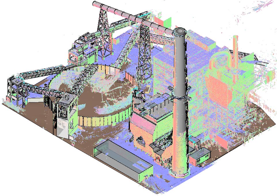
Retrofitting and Renovation

As industrial facilities evolve, the need for retrofitting and renovation becomes inevitable. 3D laser scanning simplifies this process by enabling the generation of existing infrastructure from millions of captured data points. Engineers can assess structural integrity, evaluate space utilization, and plan modifications with precision. The technology minimizes disruptions to ongoing operations while maximizing the efficiency of renovation projects.

In Conclusion

While traditional scanning methods have served industrial facilities well in the past, the advent of 3D laser scanning technology heralds a new era of precision, efficiency, and innovation. This technology offers a transformative solution for industrial construction and renovation projects, surpassing traditional surveying methods in accuracy and adaptability. By leveraging advanced scanning technologies, construction professionals can navigate the design, construction, maintenance, and retrofitting of industrial structures with ease, ensuring seamless project execution and optimal outcomes.

The ability of 3D laser scanning to capture precise spatial data, streamline workflows, and enhance decision-making processes is pushing the boundaries of innovation and proving pivotal in revolutionizing construction techniques and renovation in industrial settings. By embracing 3D laser scanning technology, industries can position themselves for greater reliability, sustainability, and excellence.

Interested in implementing 3D laser scanning technology for your next project?

Get in touch with us today to see how we can help!


Categories
Blog

Laser Scanning for Healthcare Construction & Renovation

The role of 3D Laser Scanning in Modern Healthcare Construction & Renovation

In the dynamic realm of healthcare construction and renovations, where precision, efficiency, and uninterrupted patient care are of utmost importance, safety and seamless coordination become non-negotiable.

Enter 3D laser scanning—a revolutionary technology that not only streamlines hospital construction and renovations but also offers numerous advantages in navigating the intricate landscape of modern healthcare environments. 3D laser scanning is reshaping how contractors approach complex projects.

In this article, let us explore the significance of 3D laser scanning in hospital upgrades, emphasizing its role in the construction workflow while ensuring uninterrupted operations and delivering outstanding results.

THE ROLE OF 3D LASER SCANNING IN MODERN HEALTHCARE CONSTRUCTION & RENOVATION

Navigating the Complexity of Healthcare Renovation

Embarking on hospital renovations demands meticulous planning and coordination, especially when the facility must remain operational throughout the process. Integrating 3D laser scanning requires a thorough understanding of the unique challenges posed by healthcare environments. Let us take a closer look at some of these challenges.

In older hospital facilities, the presence of asbestos above the ceilings can pose additional challenges. This requires the use of contamination carts. Additionally, it is vital to exercise utmost caution when displacing ceiling tiles and factor in the delays caused when scanning these areas due to asbestos abatement.

  • CAPTURING THE COMPLEXITY OF MEP

The density of Mechanical, Electrical, Plumbing, and Fire Protection (MEPFP) systems in hospitals is incredibly high. It requires capturing every intricate detail with the required accuracy. 3D laser scanning can provide a comprehensive overview of these complex systems to facilitate informed decision-making during renovations.

  • STAKEHOLDER COORDINATION FOR OPTIMAL OPERATIONS

Patient care with minimal disruption is a priority. This requires seamless coordination between the nursing staff and facility management teams. Therefore, we need a qualified, experienced Laser scanner provider who has effective communication and collaboration with the healthcare team.

At times, scanning outside of regular business hours can prove beneficial in minimizing disruptions to hospital operations. Through strategic scheduling, construction, and surveying teams can optimize the time required for scanning and accomplish tasks without impacting critical hospital operations.

  • PROTECTING PATIENT PRIVACY

Hospital environments store extremely sensitive patient records and confidential information. Before scanning, it is imperative to safeguard all patient information to ensure no unintended capture. 3D laser scanning providers implement strict measures to protect patients’ privacy throughout the scanning process.

Additionally, scanning emergency rooms presents unique challenges due to their heavy footfall, constant activity, and complex layouts. Scanning emergency rooms requires the use of specialized strategies for accurate data collection with little to no disruption to emergency services.

Laser Scanning for Healthcare Construction & Renovation

Tapping into the benefits of 3D Laser Scanning in Hospital Renovations

Beyond addressing the logistical complexities of healthcare construction discussed above, 3D laser scanning offers many advantages that propel hospital renovation technology into the digital age. Let us look at some reasons why 3D laser scanning is emerging as an invaluable asset.

  • Precision and Acurracy Redefined

As healthcare facilities strive to modernize and expand to meet growing demands, the role of 3D laser scanning becomes a game-changer.

3D laser scanning captures detailed measurements of existing structures to create as-built data with unmatched precision. This groundbreaking tool can minimize errors and discrepancies and ensure that renovations proceed smoothly and according to plan.

Whether it is mapping out floor plans, assessing structural integrity, or analyzing spatial constraints, 3D laser scanning provides a comprehensive understanding of the existing infrastructure, laying the foundation for a successful renovation project.

Through 3D laser scanning, hospitals can overcome the inherent challenges of construction and achieve greater collaboration with improved efficiency and accuracy.

  • Enhanced Safety Measures

The safety of everyone is paramount in healthcare operations, whether it is the hospital staff, patients, or visitors. Traditional renovation methods pose several risks, such as manual measurement errors and hazardous working conditions. However, 3D laser scanning can address these challenges by enabling remote data collection in hazardous or hard-to-reach areas and minimizing the need for personnel to be present on-site.

Furthermore, the comprehensive data captured through 3D laser scanning allows construction teams to proactively identify potential safety hazards and ensure a secure working environment throughout the renovation process and compliance with stringent regulatory standards.

  • Optimize Efficiency with Digital Construction

Time is of the essence in hospital renovations, as any delay can impact patient care and day-to-day operations. Traditional surveying and documentation methods are time-consuming and labor-intensive, often leading to project delays and increased costs.

3D laser scanning can streamline the data collection process by significantly reducing the time required for site assessment and measurement. By capturing millions of data points in a matter of minutes, 3D laser scanning fast-tracks the construction workflow by digitizing the entire process.

From initial surveys to as-built documentation, 3D laser scanning streamlines the healthcare renovation process and enables construction teams to proceed with confidence, completing renovations on schedule and within budget.

Further, by overlaying scanned data with proposed design plans, 3D laser scanning can identify clashes and conflicts early in the project lifecycle. This proactive approach helps minimize rework and ensures a smooth construction process. This enhanced visualization can also facilitate informed decision-making among stakeholders, such as architects, contractors, MEP consultants, and facility managers, to collaborate more effectively to achieve better outcomes.

  • Cost-effective Solution for Future-proofing hospital infrastructure

The as-built documentation produced by 3D laser scanning can serve as a valuable resource not just for ongoing maintenance but also for laying the foundation by providing a comprehensive digital record of the building’s structure and systems for future planning and expansion. By eliminating rework, minimizing errors, and optimizing resource allocation, 3D laser scanning ultimately leads to significant cost savings over a renovation project.

Moreover, the enhanced precision and efficiency offered by 3D laser scanning translates into shorter project timelines, reducing labor costs and minimizing disruptions to hospital operations. As hospitals aim to deliver quality care within budgetary constraints, 3D laser scanning emerges as a cost-effective solution, delivering measurable returns on investment.

In conclusion

Innovation is the key to success in the rapidly evolving landscape of healthcare construction. By embracing the power of 3D laser scanning, hospitals can navigate the complexities of renovations with confidence and precision. From streamlining workflows to enhancing collaboration and ensuring compliance, this transformative technology unlocks a world of possibilities for healthcare facilities striving to deliver the highest standard of care.

As the demands of modern healthcare continue to grow, so does the importance of welcoming digital construction technologies like 3D laser scanning. By harnessing data-driven insights and streamlining construction, hospitals can meet today’s needs and prepare for tomorrow’s challenges. With 3D laser scanning as a cornerstone of their construction workflow, healthcare facilities can embark on renovations with confidence and minimal disruption, equipped with the tools and technology to succeed and meet the ever-changing needs of patients and practitioners alike.

Categories
Blog

Exploring the Advancements in 3D Laser Scanning Technologies

Reality capture technology has revolutionized the way we replicate and interact with the physical world by transforming it into a virtual environment. Using sophisticated software and advanced hardware, such as laser beams, sensors, and GPS, 3D laser scanning technologies have emerged as powerful tools for capturing accurate and detailed information of the current condition of various project types.

In a laser scanning system, light waves are emitted by the scanner and bounce off surfaces before returning to the sensors. By measuring the time taken for the light beam to complete its journey, the sensor calculates the distance to each surface. This process is repeated multiple times, capturing thousands of individual points that are then compiled into Point Cloud files. These files create a digital representation of the scanned surfaces, providing precise dimensions and spatial relationships of the captured geometry.

It’s important to note that a laser scanner can only capture what is within its field of view, limiting its coverage to specific areas. This limitation requires the expertise of the technician to choose the most convenient equipment, set ups and strategy to perform the scanning.

Choosing 3D Laser Scanning Technologies

When it comes to choosing the right scanning technology, there are three primary types to consider, each suited for different purposes. Let’s explore these types and their ideal scenarios of use:

STATIC SCANNING – (Terrestrial Scanning)

Static scanning is well-suited for large projects that require high accuracy. It excels at capturing extensive amounts of data with exceptional precision. Here are some key characteristics of static scanning:

  • Scans per day (normal pace): 100
  • Average precision: 1/8”
  • Ideal for verifying existing conditions, construction accuracy and progress, critical material placement, as-built clash checking, detailed visualization, and verification of floor flatness and wall verticality.

DYNAMIC SCANNING – SLAM (Mobile Scanning)

Dynamic scanning, also known as SLAM or mobile scanning, is the preferred method for capturing substantial amounts of data with medium precision. Its capacity depends on the scanning device but is generally suitable for small and large projects that require moderate accuracy. Consider the following aspects of dynamic scanning:

  • Sqft/day: 300,000 with NavVis or Heron
  • Precision: 1/4” – 1/2” with NavVis, VLX or Gexcel Heron.
  • Ability to get onto control in the field.
  • Useful for verifying existing conditions, spatial and physical assets, construction accuracy and progress, construction logistics and sequencing planning, and emergency planning.

HYBRID SCANNER AND TOTAL STATIONS

The Hybrid Scanner and Total Stations are useful for small and large projects which need high accuracy, while also creating survey control. They can be used as layout instrument when not scanning.

  • Great for capturing medium amounts of data with high precision.
  • Scans per day (normal pace): 50 for the Topcon GLT-1200
  • Precision: 1/8”
  • Allows for control in the field.
  • Can create new survey points when a lack of points is in your field of view.

So, which Laser Scanning Technology should I choose?

As you may have read, the best Laser Scanning Technology depends on the characteristics and project purpose and scope. However, our Sirvey team has the knowledge and expertise to help you choose the correct Laser Scanning Technology!

By submitting your request, we can connect you with the most suitable laser scanning provider for your project’s needs. Sirvey has a highly prequalified Laser Scanning Network, providing coverage wherever you need it.  As we believe Reality Capture is the way to go for all in the AEC industry, our goal is to make Laser Scanning accessible and easy for everyone.  

Contact us today and get started on your Laser Scanning project with Sirvey!

Categories
Blog

Understanding the Costs of 3D Laser Scanning: A Comprehensive Guide 

3D laser scanning has become an increasingly popular tool for various industries due to its unparalleled ability to capture precise measurements and detailed images of physical objects and environments. However, one of the primary concerns of those considering utilizing this technology is the cost associated with it. In this article, we will break down the factors that contribute to the cost of 3D laser scanning and provide you with a comprehensive guide to help you better understand the costs and benefits of this technology. 

cost of 3D laser scanning

Introduction 

3D laser scanning is a powerful technology that has revolutionized the way we capture and analyze physical objects and environments. It has a wide range of applications across various industries, including engineering, architecture, construction, and manufacturing, among others. However, as with any advanced technology, the cost of 3D laser scanning is a primary concern for many individuals and businesses. 

What is 3D laser scanning? 

It is a process that involves using a laser scanner to capture precise measurements and images of physical objects and environments. The equipment emits a laser beam that sweeps across the object or environment, capturing millions of points of data that are then used to create a digital 3D model. This model can be manipulated, measured, and analyzed using specialized software.  

Why is 3D laser scanning important? 

3D laser scanning has become an essential tool for various industries due to its ability to capture accurate measurements and detailed images quickly and efficiently. This technology has a wide range of applications, from creating 3D models of buildings and structures for construction and architectural design to capturing precise measurements of parts for manufacturing and reverse engineering. Learn more about Laser Scanning and how does it work.

Factors that affect 3D laser scanning costs

The cost of 3D laser scanning varies depending on several factors, including:

  • The size and complexity of the project are significant factors that contribute to the cost of 3D laser scanning. Larger and more complex projects require more time and resources to complete, resulting in higher costs. 
  • The level of detail required for the project is another critical factor that affects the cost of 3D laser scanning. The higher the level of detail required, the more time and resources are needed to capture the necessary data, resulting in higher costs. 
  • The type of equipment used for 3D laser scanning is also a factor that affects the cost of the project. Advanced equipment with higher accuracy and resolution capabilities can cost significantly more than basic equipment… but don’t worry, you might not always need the most expensive option!
  • The distance between the scanning location and the company that performs the survey can also affect the cost of the project. Projects that require extensive travel can add to the total cost. 
  • The timeframe for completion is another factor that affects the cost of 3D laser scanning. Rush projects with short deadlines may require additional resources and manpower to complete the survey on time, resulting in higher costs. 

Benefits of 3D laser scanning 

Despite the costs associated with 3D laser scanning, the benefits of this technology make it a worthwhile investment for many businesses, let’s go over a few of them:

  • Precise measurements: 3D laser scanning provides highly accurate measurements that are essential for industries such as engineering and manufacturing. 
  • Detailed imaging: This technology captures detailed images that can be used for analysis and modeling. 
  • Time and cost savings: The survey can save time and money by reducing the need for manual measurements and inspections. 
  • Improved safety: The results can be used to inspect and monitor structures and environments. It helps to improve safety for workers and the public. 

Guide to hiring 3D laser scanning services

Finding the right laser-scanning provider to capture existing conditions can be a daunting task. Here are some factors to consider when selecting a provider:

  1. Experience and Service Level: Choose a provider with the appropriate experience and service level to ensure high-quality deliverables.
  2. Scanning Technology Options: There are a variety of scanning technology options available, and it’s important to select the one that best suits your needs. Be wary of vendors who push a particular technology without considering your specific requirements.
  3. Pricing: There can be inexplicable variations in pricing, making it difficult to make an informed decision. Look for a provider that offers transparent and competitive pricing.
  4. Provider Mapping: Conducting an extensive scanning-provider mapping exercise can help you avoid unnecessary expenses and low-quality suppliers.

How can we help you?

Our mission is to make Laser scanning easy for everyone. Considering the factors that affect 3D laser scanning costs, at Sirvey® we’ve developed the most prequalified 3D Laser Scanning Network. Thanks to our platform, you do not need to be concerned about cost-benefit analysis.

With SirVey®’s extensive network of pre-qualified providers, you can make a cost-effective, practical choice while receiving high-quality deliverables. Furthermore, the SirVey® team will handle everything for you, from selection and project initiation to logistical coordination and results. All you need to do is request your scan through www.sirvey.us.


Categories
events

Recapping the Remarkable A’23 Event

Sirvey’s Experience and Highlights in the Conference on Architecture 2023 (A’23)

The event, hosted by the renowned American Institute of Architects (AIA) in San Francisco, was a fantastic opportunity for us. Alongside 500+ leading brands and building product manufacturers, we had the privilege to showcase our platform and services. It was a valuable experience connecting with industry professionals and sharing our innovative solutions. We’re proud to have been a part of such an exceptional event.

Did you have a chance to stop by Booth #1238 on the expo floor? Our team of experts was there. They provided valuable insights, demonstrated the capabilities of SirVey®, and highlighted how it can streamline your projects. All this is achieved with the use of laser scanning and reality capture technology.

Say goodbye to excessive costs, lengthy timelines, and project delays. Although the event has concluded, we look forward to future opportunities to connect with you and showcase the practical benefits of SirVey®.

Couldn’t make it to the A’23? No worries ! You can still learn more about our services by exploring our website: www.sirvey.us

Any questions?

Do you have any further queries or would you like more information? Don’t hesitate to get in touch with us!

Categories
Blog

Why we created SirVey? 

Over the past few years, we have gained extensive and varied experience in hiring laser scanning providers. However, we’ve realized that when it comes to price, quality, and logistics, there is a considerable amount of uncertainty and unpredictability. Considering the challenges of the Reality Capture Industry, we created a Laser Scanning Platform: Sirvey.

Challenges of the industry

Let’s start with what we’ve learned so far:

  • Quality: We do not compromise on quality. Choosing the wrong technology or not having enough experience in the geospatial capture field, among other factors, can make selecting a new laser scanning provider a real challenge. We know that point cloud integrity dramatically affects not only how an existing-conditions model will be developed but also how trustworthy it will be down the road. An incomplete or inaccurate 3D model impacts all the stakeholders and processes downstream in the design, coordination, and construction process. 
  • Pricing: From a pricing standpoint, there are many questions to consider. How much should we pay for a project to be scanned? To what extent do travel costs and accommodation fees affect the overall scanning cost? How much productive time does a laser scanning technician lose by getting around and waiting at the airport boarding gate? How much does equipment shipping cost? These are just a few of the many questions we ask ourselves daily. 
  • Scope: The scanning purpose determines the technology to be utilized along with the associated deliverables. When attempting to refine the scope of work, many questions may arise. Does the project need survey control? Is above-ceiling scanning necessary? What will the scanned data be used for? Do we want the point cloud data for space planning, marketing material, or to coordinate MEP trades for future retrofits? Should we scan the façade, roof, and site as well? These are just a few of the inquiries that need to be answered. 
  • Site Constraints: Site conditions can significantly impact scanning times. Should we cut holes in the hard ceiling to pass the scanner through or are there ceiling tiles that can be easily removed? Is the roof accessible, or should we scan from the surrounding buildings? Is flying a drone permitted in that specific area? Is the pilot certified? Should we rent a scissor lift to access some attic spaces? Who will take care of all those logistics? This sounds like a huge coordination effort. 

These challenges are the reason why we’ve developed SirVey. Our mission is to make Laser scanning easy for everyone. 

sirvey

About Sirvey

We’ve realized that technology can sometimes be overwhelming. As we believe that reality capture is the way to go for all AECO projects, we want to change that perception. By applying the principle of Shared Economy like Airbnb or Uber, we want to ‘uberize’ the laser scanning processes by connecting AEC stakeholders that need laser scanning for their projects with the closest and best possible service provider. With this, we ensure more predictable quality results and provide the best user experience through project management and communication standards. 

Our goal is to promote and democratize the use of laser scanning technology, making it accessible to everyone. We are committed to making the process easy for our clients by offering various scanning options, that are best suited for their project’s needs, including colored scans and 360 pictures, as well as terrestrial, aerial, or mobile scanning. We also ensure the point cloud density, file breakdown, and size meet those needs. Additionally, we handle the heavy file transfer and storage for our clients, making the process as seamless as possible. Trust SirVey to take care of your scanning needs. We coordinate and oversee the entire process, so you can just unplug. Of course, we can assist you with BIM models and drawings as well. 

Our prequalified Laser Scanning Network provides covering wherever you need. We have technicians located on all major national markets, so they get the job done within driving distance of your projects. Our proximity enables us to provide a quick turnaround time. Additionally, we bid on each project, allowing us to offer the most competitive option. Lastly, since our providers undergo a rigorous qualification process to join our network, you can rely on our deliverables with confidence. 

Want to try SirVey? Require a quote here! We’re pleasure to hear about you.  

Categories
Blog

5 suggestions for a successful Scan to BIM project 

Laser Scanning is the initial step to reflect the true As-Built conditions and provide proper information for the specific model purpose. But what comes after? At Sirvey, we manage the entire process, including Scan to BIM, to provide comprehensive support. 

But first, what is Scan to BIM?

In simple terms, it involves taking millions of data points from an existing facility using point clouds, and then converting them into an intelligent 3D BIM model that represents the As-Built conditions. This model can be used for a variety of purposes, such as redesign and renovation, spatial coordination of new MEPs with existing ones, and facility management. 

Architects, engineers, MEP designers, contractors, surveyors, and owners are among those who currently benefit from this technology, as it allows them to create accurate architectural, structural, and MEP models that reflect the actual conditions of a building. 

scan to BIM

Let’s check the suggestions!

That said, it is important to follow certain rules to produce a model that accurately reflects the as-built conditions and serves its intended purpose. Here are some suggestions to keep in mind: 

  1. Quality: Before starting any Scan to BIM project, it’s essential to check the quality of the point cloud. These are 3D files made up of individual points in digital space, each with X, Y, and Z coordinates. These files contain vast amounts of information about an object, including its physical location, shape, color, and reflectivity. By checking the quality of the point cloud, you can identify any issues early on and prevent the need for future rework. Learn more about point clouds here. 
  1. Coordinates: To ensure accurate location of a model, it’s important to ask the surveyor all the necessary questions. Properly locating a point cloud requires attention to detail, and it’s essential to verify that the origin point of the cloud is sufficiently close to the building. This helps the model stay within the Revit comfort zone and avoids potential export inaccuracies. In addition, if multiple point clouds belong to different zones or buildings, it’s important to confirm that the surveyor has correctly linked them together. By taking these steps, future headaches can be avoided. 
  1. Drawings: It’s important to use the point cloud as the primary source of information, instead of relying on As-Built drawings. As-Built drawings can be inaccurate and fail to reflect the true conditions of the building, which can lead to discrepancies in the final model. Using the point cloud as the main source of information ensures greater accuracy and minimizes the risk of errors in the final product. 
  1. Assumptions: It’s important to avoid making assumptions about the elements within the point cloud. If there is any uncertainty about which system an element belongs to, it’s better to leave it unassigned than to incorrectly assign it. Assigning an element to the wrong system can lead to errors in the final model, and it’s better to take the time to confirm the system before doing it. By avoiding assumptions and double-checking the system assignments, the final model will be more accurate and reliable. 
  1. Visual verification: Automated tools can be useful for verifying the accuracy of a model, but a thorough walkthrough and manual quality control are still necessary. This approach can detect any inconsistencies and ensure confidence in the deliverables. 

By following these suggestions, you can ensure that your Scan to BIM projects accurately reflect the true As-Built conditions and provide the necessary information for the specific model purpose. If you have any inquiries or doubts, feel free to contact us. 

Needing Laser Scanning providers? We have the best pre-qualified Laser Scanning providers for you. Require a quote at Sirvey

Categories
Blog

What is Laser Scanning and How Does it Work? 

Laser scanning technology has become increasingly popular among companies in the Architecture, Engineering, and Construction (AEC) industry in recent years. Discover how it works and its different types of applications.  

Laser scanning technology captures the existing conditions of a site in high quality and in a digital format that can be accessed from anywhere with just a click of a button. The laser scanner can quickly and easily capture any shape or object, even with complex geometric forms, in a three-dimensional digital form using various laser points and lines. This scanned environment includes millions of data points presented together as point clouds with X, Y, and Z coordinates, enabling users to create the most accurate 3D models. We will discuss point clouds in more detail shortly. 

Moreover, laser scanning can be used in various stages of a project, including design, construction, renovation, demolition, and more. Many professional laser scanning service providers also offer scan-to-BIM services that streamline the process of data collection and drawing development. At Sirvey, powered by ENG, we provide high-quality, detailed, ready-to-use 2D drawings and 3D models. Contact us today to learn more about how we can assist you with your next project. 

Laser scanning technology involves various phases, from scanning and registration to deliverables management and more. In this article, we will delve into how laser scanning works and the types of data formats this technology offers. 

laser scanning

How Does it Work? 

Laser scanning technology has undergone significant advancements in recent years, not only in the way that the data is captured, also, providing faster and more precise scanning results. One popular option to perform the laser scanning survey is using terrestrial-static scanners mounted on a tripod base, which rotates at high speeds upon activation, emitting a low-energy, infrared laser light with exceptional precision.

The scanner’s rotating mirror captures 360-degree images of the surrounding environment using light. The laser head then scans the area, bouncing off each object in its path and recording approximately one million data points per second with a spacing of 1 to 3 mm. The resulting data is a point cloud file that contains detailed measurements in X, Y, and Z coordinates, and may also include RGB values for each point. 

To achieve the most accurate coordinates of any surface, structure, or surroundings, some modern laser scanners employ laser beams, advanced sensors, Global Positioning Systems (GPS), Inertial Measurement Units (IMU), receiver electronics, and photodetectors. 

Laser scanning has revolutionized the way we measure and map objects and environments. It is widely used in the fields of architecture, engineering, and construction to create accurate models of buildings, roads, and other infrastructure. It is also utilized in the entertainment industry to produce realistic special effects in movies and video games. 

Read the benefits of laser scanning for the AEC industry here

Types of Laser Scanning deliverables

When it comes to laser scanning, these are the 2 most common deliverables: Point Clouds and 360 Views. Let’s take a closer look at each one. 

Point Clouds  

The laser mapping process captures a large number of 3D survey points for any given object or surface. This data is referred to as a Point Cloud. These data points are converted into standard file formats through a process called registration or “stitching”. They can be viewed as 3D models on various software applications such as Recap, AutoCAD, Revit, Navisworks, and Bentley MicroStation. Point clouds are also available in different file formats such as .ptx, .e57, .rcp, .rcs, .xyz, .pts, and .pod. Point clouds can be used to create both 2D drawings and 3D models. 

However, point cloud files can be quite large to work with due to the millions of data points captured, which is a common concern expressed by many users. To reduce file size, point clouds can be decimated, which involves removing points based on spacing and percentages. Point cloud processing software usually has the ability to decimate files based on set parameters, but this should be done carefully to avoid affecting the quality and functionality of the final product. 

If you’re working Autodesk’s Recap software, the preset point resolution for its files is 5 millimeters. Although, it’s available to choose a resolution between 1 to 100mm. So, it’s up to the user to determine whether they need a file with a tight resolution for additional details or a lighter file size for ease of use. 

laser scanning

Greyscale and Colored Point Cloud 

The scanning process captures data in black-and-white initially, but it can be configured to take color photos to generate a colored point cloud. However, for construction-focused laser scanning, it’s important to discuss and agree with the client on their specific requirements beforehand. During the scanning process, objects are assigned a greyscale value ranging from 0 to 100, which is determined by their reflectivity and the angle of incidence. 

One of the interesting features of laser scanning is that it does not require spaces to be illuminated, and it can perform reality capture in complete darkness. Furthermore, laser scanners can capture spaces in full color by taking hundreds of tiny pictures that are stitched together to form a color, stereoscopic image. The processing software then applies color to the scanned 3D data points, resulting in a complete, full-color 3D point cloud. However, it’s important to note that for capturing stereoscopic pictures, a laser scanner requires well-illuminated spaces.  

Structured vs Unstructured Point Clouds 

Structured or non-unified point clouds are created using terrestrial or tripod laser scans, and the scanner records individual locations of scan positions, real views, and depth maps. The data from these scans can be used to create mesh models, where each point is visible in 3D space. Structured scans are typically produced using devices like Faro, Leica, Z+F, Riegl, Topcon, and Trimble and support file formats like .FLS, .PTG, PTX, ZFS, CLR, RSP, and RDBX. 

In contrast, unstructured or unified point clouds are generated using mobile lidars and drone-based photogrammetry, which produce unstructured data since there are no scan positions associated with a depth map, as in tripod scans.  

Each point cloud software provides users with the capability to produce a unified point cloud. While structured data can be transformed into an unstructured point cloud, the reverse process is not viable. 

Unified data combines all the scans into one individual file, but it loses the “structure” of the project and panoramic images. This makes it somewhat easier to operate in modeling applications like Revit. 

360 Views  

360 Views are a deliverable offered by of laser scanning technology. However, 360 Views have an added benefit as they allow users to explore a site multiple times from their computer. With the use of compatible software, 360 Views offers features such as markups and the attachment of additional information like images and PDF files. Collaborative work is made easier as all the scanned information can be accessed remotely. 

360 color pictures are often used alongside point clouds to provide further survey records. These images can be combined with the 3D scanned data points to create a scalable representation of the site. 

The color images can be installed on a local computer to create portable 360-degree panoramic views of the scanned data. This is especially useful when on-the-go and unable to access a cloud-based resource or dedicated server. Accessing the images is simple; each scanner brand offers the possibility of a portable viewer, sometimes online and sometimes offline. 

Specialized software, like TruView, allows for enlarged and rotated images to view specific details and site dimensions. Additionally, this software can be used to identify structural defects such as cracks, sagging beams, or bulges in walls that may have been missed during on-site inspections. 

The most Ultimate Deliverable 

Additional deliverables can be created using point cloud data, depending on the initial scanning purpose. Whether it’s for creating a base model for 3D model coordination or a record model for an existing facility, the process for creating these deliverables is similar. Let’s explore how this works. 

From Laser Scan to 3D Models  

The scanned data from existing building can be used to create detailed 3D BIM models. In general, the resulting point cloud is linked to software like Revit, and using different views and modeling techniques, the modeler can start tracing the points to build the 3D digital geometry of the required building components. Precision and experience are necessary for creating 3D models from point clouds.

Developing complex 3D models of existing and historic buildings using scanned survey data has never been easier, as the scanned data can be directly integrated from point clouds to drafting platforms like Revit. 

From Laser Scan to 2D Models  

Once a 3D model has been created from the point cloud using software like Revit, 2D representations of the geometric forms can be extracted and annotated to produce a complete set of as-built 2D drawings. Additional details, such as floor tags, material specifications, and pipe elevations, can be added to the 2D drawings to create finished documents. As these drawings are generated from 3D models, the process of developing base drawings can be accomplished in a matter of minutes! 

Conclusions 

In recent years, laser scanning services have become more common and affordable throughout all design and construction phases. It’s clear that this versatile tool can save thousands of dollars by minimizing errors, rework, and change orders. Additionally, incorporating point clouds into your workflow offers remote workability for all stakeholders and helps keep projects on schedule. 

As a part of the evolving AEC industry, it’s important to keep an open mind about technological breakthroughs in the market and use them to stay ahead of the competition. 

If you’re considering implementing this cutting-edge technology for your next project, consider Sirvey! Please contact us today to determine how we can help you achieve your scanning and documentation goals! 

Wondering how is the laser scanning process? Click here and learn more about it.  

Categories
Blog

The use of Point clouds and Laser scanning for the AEC industry 

Point Clouds and Laser scanning are crucial to understanding the existing site conditions and structures before starting a project in the AEC industry. Let’s dig more into them! 

As the AEC industry becomes more competitive, delivering projects on time and within budget is more crucial than ever. However, measuring existing site conditions and structures using traditional methods often results in inaccuracies and inconsistencies, leading to project delays, rework, and cost overruns. Fortunately, laser scanning technology and point clouds are revolutionizing the way architects and engineers approach their projects. 

Before we delve into the details of laser scanning technology, let’s first understand the basics and how you can benefit from this cutting-edge technology!

Laser Scanning  

Also known as Reality Capture, High-Definition Surveying (HDS), or LiDAR (Light Detection and Ranging), Laser Scanning is a process of capturing and mapping detailed building data using laser beams. It is similar to taking a picture with your camera but with a much higher level of precision for each pixel. The resulting data is called a “point cloud,” which can be used to create 2D drawings such as plans, elevations, cross-sections, 3D textured models, and more. We will discuss point clouds in more detail shortly. 

Although laser scanning technology has been available for decades, what has changed is the hardware and software that has enhanced its efficiency and reduced its cost, providing a more efficient way to get the job done. It can be used for designing purposes by adopting the scan-to-BIM application when the project starts, during construction for MEP coordination, and to create as-built records, retrofits, and renovations.  

Learn more about Laser scanning and how it works

Point Clouds 

Point clouds are 3D point files that make up an object in digital space, each with X, Y, and Z coordinates. They contain vast information about an object, including its physical location, shape, color, and reflectivity. Through a process called registration, this dataset represents the spatial measurement as a whole.  

Laser scanning generates a point cloud that comprises millions of data points, which can create a precise 3D model of any building. This point cloud can be easily imported into popular CAD or BIM software to generate 2D drawings or 3D renderings. Point clouds can be used to develop comprehensive floor plans, BIM models, track construction progress, and perform other functions. 

point clouds

Advantages of Point clouds and Laser Scanning Technology 

Laser scanning produces a point cloud containing millions of data points that recreates an accurate 3D representation of any building. This technology offers significant benefits, such as: 

Enhanced Speed and Accuracy

Architects and designers can enhance the accuracy and quality of their proposals, save time traveling between the office and job site, and devote more time to creating error-free design alternatives by utilizing laser scanning. This technology allows them to create detailed files for off-site review, resulting in reduced costs and time associated with revisits and rework. 

Laser scanning also enables design professionals and contractors to obtain exact site dimensions with a simple scan. This facilitates the creation of well-coordinated drawings that seamlessly integrate structural elements, ductwork, electrical lines, and water pipes on the first attempt. 

With laser scanning, millions of data points can be captured per second, providing precise geometric details of even the most intricate structures. This reduces the time required to measure field conditions and boosts overall productivity. 

Streamlined Coordination 

Laser scanning can aid in the creation of intelligent digital environments, promoting informed decision-making, outcome evaluation, and efficient productivity tracking. Integrative workflows can be developed, streamlining coordination and improving overall project performance. 

The implementation of the scan-to-BIM technique allows design professionals to quickly identify errors and compare different project stages within the BIM environment. This also facilitates the use of modern manufacturing techniques, such as 3D printing and off-site material prefabrication. 

In the current era of remote work, digital files provide easy access for all stakeholders, promoting real-time information sharing for collective decision-making, problem-solving, and enhanced coordination. 

Insight into Existing Conditions

Scanned data provides valuable insight into existing site conditions that can be viewed in real-time, enabling on-the-spot decision-making if necessary. Accurate and comprehensive information reduces the likelihood of costly errors and rework.  

Furthermore, scanning enables a thorough understanding of a site and the creation of accurate 3D models for large-scale projects in a short time frame. This approach helps identify and prevent errors, saving money and reducing manual labor.

point clouds

Laser Scanning´s Challenges  

Before finish, it´s important to notice that implementing laser scanning services has some challenges. First, it may have a higher upfront cost, but it helps lower the overall project cost when done right. Additionally, laser scanning relies on skilled and trained professionals to achieve the best results. Offering employee training to bridge the skill gap can add to the upfront costs. Finally, laser scanning can produce detailed drawings for any location, but to get the best outcome, it’s beneficial if the operator is familiar with the given site. 

Conclusions 

Point clouds and Laser scanning technology offer a new level of precision and accuracy that benefits AEC professionals. With its ability to capture and recreate 3D representations of existing buildings, this technology enhances speed and accuracy across all projects, streamlines coordination, and provides insight into existing conditions. Although there are challenges to implementing laser scanning services, the advantages far outweigh them, making this technology an essential tool for any AEC project. 

At SirVey, we use the latest scanning hardware to provide as-built field measurements for any facility. We can process this data to deliver finished 2D drawing or 3D model files, tailored to meet our clients’ vision and goals. With our real-world expertise and years of experience, we deliver best-in-class results. 

If you are interested in implementing point clouds and laser scanning services for your next project, reach out to us at SirVey today to discover how we can assist you! 

Categories
Blog

What does a typical Laser Scanning process look like?

Laser scanning is a widely used technology in various industries, including construction, architecture, engineering, and surveying. It involves the use of a laser scanner to create a three-dimensional (3D) model of a site, which can be used for a range of applications, including design, analysis, and visualization. In this article, we will explore what a typical laser scanning process looks like.

laser scanning process

Let’s explore the steps involved in implementing laser scanning technology, which include:

Scanning

Laser scanning is not only about creating impressive visuals but also about collecting accurate information. In theprocess, it is crucial to identify the purpose and desired outcome of the physical act of surveying, as this technology allows us to seamlessly recreate any environment. Generally, scanning a site can be broken down into two steps: pre-site work and work on-site.

Pre-Site Work

Pre-site work involves understanding the extent of the work. It includes the information to be gathered during the survey, the essential areas to be covered, specifics of the site or facility such as square footage, levels, elevations, ceiling types, existing building conditions, project timeline, among others.
It’s essential to finish the extent of data capture since that will form the basis of your proposed survey strategy and define the primary focus of the scan. Additionally, depending on the type of work and facility to be scanned, making sure you comply with the necessary paperwork is another important step. For example, COI requirements, specific clearances, work permit, safety certificates, on-site contact information, unrestricted access to the survey site, and so on. During the pandemic and post-pandemic times, scanning may require an additional layer of safety and training to safeguard your staff.
Based on the existing information provided in the form of blueprints or photos, define a tentative workflow to be followed on-site to prevent loss of time and mitigate potential obstacles. Pre-site work, when combined with a detailed survey work path, can yield top-notch point cloud results, which form the foundation for all future models. Also, have a Plan B in case of unforeseen complications arising on-site.

On-Site Work

Before you start scanning, it is advisable to review the available information, walk around the site and coordinate with others to remove any objects, such as tiles, access panels, furniture, or scaffolding, that could potentially obstruct accurate data collection.
Once the defined project parameters have been established, the surveyor can begin scanning on-site while adjusting the density of data points collected to meet specific requirements. It is recommended to adhere to the pre-planned work path to anticipate upcoming scan positions, but be prepared to adapt the strategy according to the site’s conditions.
Moreover, it is crucial to pay close attention to the vital information that needs to be gathered on-site. Field notes should also be incorporated abundantly to assist the user in understanding how the fieldwork was carried out.

Registration Process

The registration process is carried out in the office after the completion of fieldwork. Once the scanning process is finished, a significant amount of data is stored in a compressed format on the scanning device’s hard drive. This data is then downloaded and processed to become the point cloud through a process known as registration. Software programs such as Cyclone, Scene, and ReCap are commonly used for registration. In these programs, millions of overlaid data points are “threaded or stitched together” to create a continuous project point cloud.
During registration, false data points are removed. The information collected is then converted to a standard transfer format, spread homogeneously to describe conditions inside and out. It is advisable to provide the scan positions to the user to help them identify data points in both the point cloud and 3D model format, allowing them to detect and resolve any potential conflicts.
Some service providers offer pre-registration alongside scanning to accelerate the registration process. However, the quality of the scan heavily relies on the precautions taken in the field, as well as meticulous notetaking.

Data Cleanup Process

After stitching all the scan positions together and completing the registration process, the next step is to start the data cleanup process. During scanning, extra information such as digital artifacts, vehicles, trees, people, and measurement noise is filtered out. This helps to improve the accuracy and clarity of the final point cloud data. The aim is to ensure a high-quality point cloud suitable for modeling.
Although data cleaning offers apparent advantages, it is often overlooked due to being a time-intensive process. However, it is recommended to take the time to complete this step to ensure a consistently high-quality scanned product.

Export

Exporting deliverables is a crucial step in the process. Fortunately, there are several universal formats that are supported by many design applications, making it easier to share your work with others. However, in some cases, it may be necessary to convert your files from one format to another to be able to use them with specific software.

At Sirvey, we work with a variety of clients who use different design software. Many of them rely on Autodesk Suite – specifically AutoCAD and Revit – which require files from ReCap. In these cases, we recommend requesting the RCP and RCS formats, or e57 if you’re using Bentley products, to get the POD file you need.

By using these recommended formats, you can make sure your design files will be compatible with the software your clients or collaborators are using, which can save you time and hassle in the long run. So, regardless of the project’s size or scale of collaboration, it’s important to choose the right format for your deliverables.
If you’re interested in requesting a point cloud survey through Sirvey, it’s important to understand our design workflow. While getting as-built models can be highly beneficial, we prefer having data available in RCP and RCS formats for building models, and to refer to the point cloud or insert it in Revit, AutoCAD, or Navisworks. This can help you avoid going back to the surveyor or the S2B models.

Additional point cloud formats

We offer additional point cloud formats, including unified and decimated point clouds, 360 photos, and structured point clouds. These formats may be necessary for pre-processing with automated geometry extraction software such as Edgewise.
It’s also important to consider the size of the point cloud. If you have a large project with multiple zones, areas, or levels, we recommend splitting the point cloud for ease of handling. At Sirvey, we strive to keep the point cloud file under 10 gigabytes.
By understanding our design workflow and considering these important factors, we can work together to provide you with the best possible results for your point cloud survey needs.

laser scanning process

File Transfer: Streamlining Your Workflow

The final step in the laser scanning process is file transfer. This step should be factored into your work plan as it can be time-consuming. It is important to keep in mind the standard principles of intellectual property and data ownership that apply to project deliverables. Typically, the surveyor retains ownership of the information and provides the client with a royalty-free license for defined purposes.
At Sirvey, we use ACC – Autodesk Construction Cloud for uploading, sharing, and storing point clouds as it offers unlimited space.
In addition, licenses may be needed to visualize and work with point clouds and 360 photos. There are plenty of options available. Some of them are free but come with limitations, while others require a paid license. Laser scanning service providers often offer 360 photo viewers through applications like WebShare by Faro, JetStream (TrueView) by Leica, and 360 ReCap by Autodesk.
To view and work with the 3D point cloud, the following applications licenses are required:

  • ReCap – where you can view and fly through the 3D point cloud
  • Open Software/Online Free Viewer (with limitations)
  • CloudCompare
  • Revit/AutoCAD/Navisworks – not a point cloud visualizer, but it’s possible to review the point cloud.

Conclusions

Over the past decade, Building Information Modeling (BIM) and laser scanning have made significant progress. Due to their many practical applications, they have become the preferred solution for producing quick, efficient, and precise surveying data for many construction professionals.
If you’re searching for fast and reliable data to generate accurate building models for your next project, look no further. Contact Sirvey today to benefit from our trusted and advanced 3D laser scanning service, which will enable you to deliver your best project yet!


Do you want to learn more about Laser Scanning? Read more here!